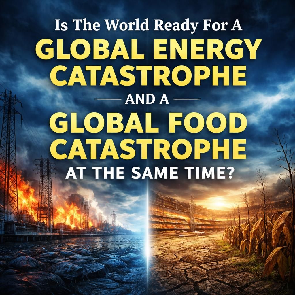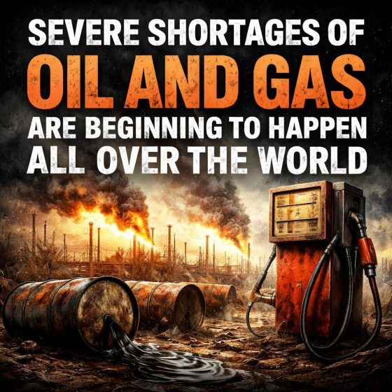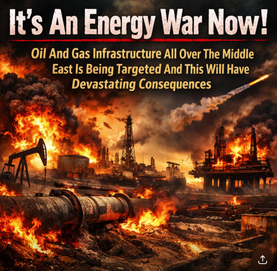
 Are we really going to go through this again? It appears that the Iranians are absolutely determined to keep traffic through the Strait of Hormuz paralyzed until they get what they want. In order to reopen the Strait of Hormuz, an absolutely massive military operation would be required, and perhaps we will see such an operation in the days ahead. But for now approximately 2,500 ships continue to be trapped inside the Persian Gulf, and this is already starting to create fuel shortages in some parts of the globe. If the Strait of Hormuz is not reopened for months, the fuel shortages will become extremely serious and it is inevitable that “energy lockdowns” will be imposed.
Don’t think that it can’t happen. Even now, the term “energy lockdown” is trending on social media all over the world…
A new term has begun trending on social media as the global oil crisis deepens: “energy lockdown.” While the phrase evokes memories of COVID-19 restrictions, experts say it describes something very different—a set of government-enforced or encouraged measures to reduce fuel, gas and electricity consumption in response to severe supply shocks.
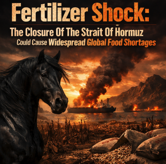
The term gained traction following the closure of the Strait of Hormuz due to the Iran-Israel-US conflict, which has cut off about 20% of global oil supplies. On March 24, the sixth anniversary of India’s first COVID-19 lockdown, the term peaked as public anxiety mixed with historical memory.
As you will see below, so far most of the energy-saving restrictions which have been introduced are voluntary.
But as global energy supplies get tighter and tighter, it is probably just a matter of time before mandatory restrictions become widespread.
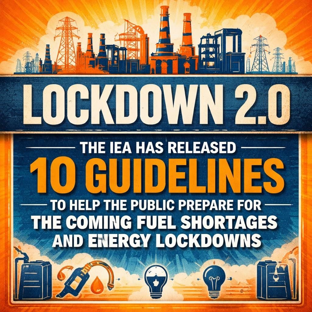
The International Energy Agency is giving us some clear indications of what could be ahead. They have just released a list of 10 emergency guidelines that some users on social media are calling a “playbook” for future energy lockdowns…
The “World’s energy watchdog” has announced a list of emergency measures the public should take to help deal with the ongoing energy crisis triggered by the war in the Middle East.
Many on social media have branded the emergency energy playbook as “lockdown 2”. One critic said: “We’re not doing this again.” The International Energy Agency (IEA) has released the list of guidelines encouraging countries across the globe to reduce fuel usage.
The suggestions given in the report, called “Sheltering from oil shocks”, consists of 10 steps focused on curbing fuel consumption. The IEA has also advised member countries – such as the UK and Australia – to prepare emergency measures to overcome oil demand.
Needless to say, we are not being encouraged to wear masks this time around.
But we are being encouraged to avoid driving and to stay home.
The following is the full list of 10 guidelines that the IEA has just released…
- Work from home where possible
- Reduce highway speed limits by at least 10km/h
- Encourage public transport
- Alternate private car access to roads in large cities on different days
- Increase car sharing and adopt efficient driving practices
- Efficient driving for road commercial vehicles and delivery of goods
- Divert LPG (liquified petroleum gas) use from transport
- Avoid air travel where alternative options exist
- Where possible, switch to other modern cooking solutions
- Leverage flexibility with petrochemical feedstocks and implement short term efficiency and maintenace measures
I think that they realize that there simply is not going to be enough fuel for everyone if this war does not end soon.
This is going to be particularly true in Asia, because they buy more than 80 percent of the oil that travels through the Strait of Hormuz…
Countries across Asia are reviving Covid-era playbooks — from work-from-home policies to fuel-saving curbs and subsidies — as they scramble to respond to a deepening energy crisis triggered by the Iran war, Reuters reported.
The region is at the frontline of the disruption, buying more than 80% of the crude that transits the Strait of Hormuz — a vital artery that has been largely blocked since the conflict began on February 28.
This isn’t a crisis that is going to happen in a few weeks or a few months.
This is a crisis that is happening now.
As I write this article, national governments in Asia “are preparing for worst-case energy scenarios”…
Governments across Asia are preparing for worst-case energy scenarios that could include a prolonged and severe disruption to supplies, even as the U.S. draws up a plan to end the war in Iran.
South Korea shifted into crisis mode on Wednesday, setting up an emergency economic task force to urgently prepare for adverse scenarios. The Philippines declared a national emergency, citing an “imminent danger of a critically low energy supply.”
Japan is reviewing its entire supply chain of petroleum-related products as the likelihood builds of shortages and knock-on effects across the economy, while India’s Prime Minister Narendra Modi warned the war could cause unprecedented challenges for the nation.
During a couple of his recent speeches, Modi made some comments that have caused a great deal of concern in India…
In his speeches in the Lok Sabha and Rajya Sabha on Monday and Tuesday about the West Asia conflict, Prime Minister Narendra Modi recalled how India faced the COVID-19 pandemic and the associated global supply chain disruptions.
“In the past too, our government did not allow the burden of global crises to fall on the farmers,“ Modi said in his address in Lok Sabha on the West Asia crisis on Monday.
On Tuesday, speaking in the Rajya Sabha, PM Modi almost repeated what he had said the day before in the Lok Sabha. Modi called upon the nation to “remain prepared and united, just as it had stood together during the COVID-19 pandemic.”
Following those speeches, Internet searches for “energy lockdown” absolutely skyrocketed.
People in India really are concerned that we could see a repeat of the darkest days of the pandemic.
Even now, the ceramics industry in the state of Gujurat has been “shut down for the best part of a month” due to a lack of fuel…
In the western state of Gujurat, a shortage of gas rather than oil has seen the region’s ceramics industry shut down for the best part of a month.
With no end in sight to the Iran conflict, the 400,000 people employed in the trade have been left in limbo.
“I will have to go hungry if I continue staying here without work,” Sachin Parashar, a migrant worker, told a local news channel.
In the vast metropolis of Mumbai, approximately 20 percent of the hotels and restaurants have already been shuttered…
In Mumbai – a city of more than 22 million people – as many as a fifth of all hotels and restaurants fully or partially shut in the first weeks of March. Items which take longer to cook are absent from menus. Long queues have formed across the nation as people try to get their hands on gas cylinders, even as the government tries to calm fears of a shortage.
“The situation [in restaurants] is dire. Cooking gas simply isn’t available,” Manpreet Singh, of the National Restaurant Association of India, which represents about 500,000 restaurants, told the BBC.
This war hasn’t even been going on for a month yet.
So what will things look like if this war continues for at least several more months?
In Sri Lanka, every Wednesday is now a “public holiday” in a desperate attempt to conserve fuel.
In Pakistan, schools have been closed for two weeks and cricket fans are being urged to stay home…
In Pakistan, authorities have asked cricket fans to stay home and watch matches on television instead of travelling, in an effort to save fuel. At the same time, the government is considering limits on how much fuel vehicles can use, according to sources familiar with the plan.
The situation is also worsening in Bangladesh, where long lines have formed at fuel stations, with some stretching up to a kilometre. Many fertiliser plants have been shut down to conserve energy, while the government is trying to secure about $2 billion in loans to meet rising power demand during the summer months.
Here in the United States, we should be very thankful that we are not as dependent on Middle Eastern oil as we once were.
Because just about everyone in Asia is really hurting right now.
Japan is tapping into their strategic reserves, and South Korea is strongly considering it…
The two east Asian nations are being rocked by surging import costs, forcing factories to scale back and governments to tap emergency reserves.
Japan, which imports more than 90% of its oil from the region, has begun tapping strategic reserves. South Korea is weighing reserve releases and emergency support measures.
Just about all of the oil that is used by the Philippines comes from the Middle East, and they have already declared a national energy emergency…
The Philippines just became the first country to declare a national energy emergency, warning of “an imminent danger of a critically low energy supply.” The island imports 98% of its oil from the gulf.
Needless to say, this is just the beginning.
If the war does not end soon, Europe will start to run out of fuel next month…
However, without a return of crude deliveries from the Gulf to global buyers via the crucial Hormuz channel, Europe could face shortages of fossil fuels within weeks, according to Wael Sawan.
The Shell chief executive told an oil industry conference in Texas: “South Asia was first to get that brunt. That’s moved to south-east Asia, north-east Asia and then more so into Europe as we get into April.”
We have never seen anything like this.
If this war stretches into the summer, there will be global panic.
Already, panic buying has caused shortages at hundreds of gas stations in Australia…
Hundreds of service stations across Australia have run out of fuel, with the federal government inking a deal with Singapore, one of the country’s biggest sources of refined petroleum, to keep supplies of diesel and petrol flowing.
Concerns are now broadening to supplies of fertiliser and other chemicals, heaping more pressure on the Albanese government’s leveraging of overseas exports of coal and gas in a bid to handle of the crisis.
The energy minister, Chris Bowen, told federal parliament on Monday that 109 outlets in Victoria had run out of at least one grade of petrol, that there were 47 outlets in Queensland with no diesel and 32 without regular unleaded, and that 37 stations in New South Wales had run out of petrol.
I wish that I could tell you that the war will be over quickly and that conditions will return to normal very soon.
But I can’t do that.
The CEO of BlackRock, Larry Fink, is telling us that he believes that if the price of oil reaches 150 dollars a barrel it will cause a global recession…
BlackRock CEO Larry Fink is warning that a prolonged conflict between the United States and the Islamic Republic of Iran could drive the price of oil to $150 a barrel and plunge the world into a “stark and steep recession.” The remarks come as U.S. military operations against the Islamist regime enter their twenty-fifth day, and amid weeks of energy and financial market volatility.
“Rising energy prices is a very regressive tax. It affects the poor more than the wealthy,” Fink notes, while further cautioning that Iran could force “years above $100, closer to $150 oil, which has profound implications in the economy.” The $150-a-barrel benchmark, according to the BlackRock CEO, is an important line to avoid crossing, as doing so would result in “a probably stark and steep recession.”
I believe that he is wrong.
I believe that if the price of oil reaches 150 dollars a barrel and stays there, it will cause a global depression.
I wish that I was exaggerating, but I am not.
We really have entered one of the most chaotic chapters in human history, and most of the population still has no idea what is in front of us.
Michael’s new book entitled “10 Prophetic Events That Are Coming Next” is available in paperback and for the Kindle on Amazon.com, and you can subscribe to his Substack newsletter at michaeltsnyder.substack.com.

About the Author: Michael Snyder’s new book entitled “10 Prophetic Events That Are Coming Next” is available in paperback and for the Kindle on Amazon.com. He has also written nine other books that are available on Amazon.com including “Chaos”, “End Times”, “7 Year Apocalypse”, “Lost Prophecies Of The Future Of America”, “The Beginning Of The End”, and “Living A Life That Really Matters”. When you purchase any of Michael’s books you help to support the work that he is doing. You can also get his articles by email as soon as he publishes them by subscribing to his Substack newsletter. Michael has published thousands of articles on The Economic Collapse Blog, End Of The American Dream and The Most Important News, and he always freely and happily allows others to republish those articles on their own websites. These are such troubled times, and people need hope. John 3:16 tells us about the hope that God has given us through Jesus Christ: “For God so loved the world, that he gave his only begotten Son, that whosoever believeth in him should not perish, but have everlasting life.” If you have not already done so, we strongly urge you to invite Jesus Christ to be your Lord and Savior today.