A Yellow Alert Has Just Been Issued For 2 Major Volcanoes In North America

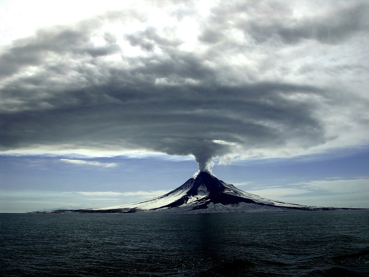
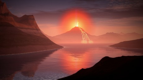
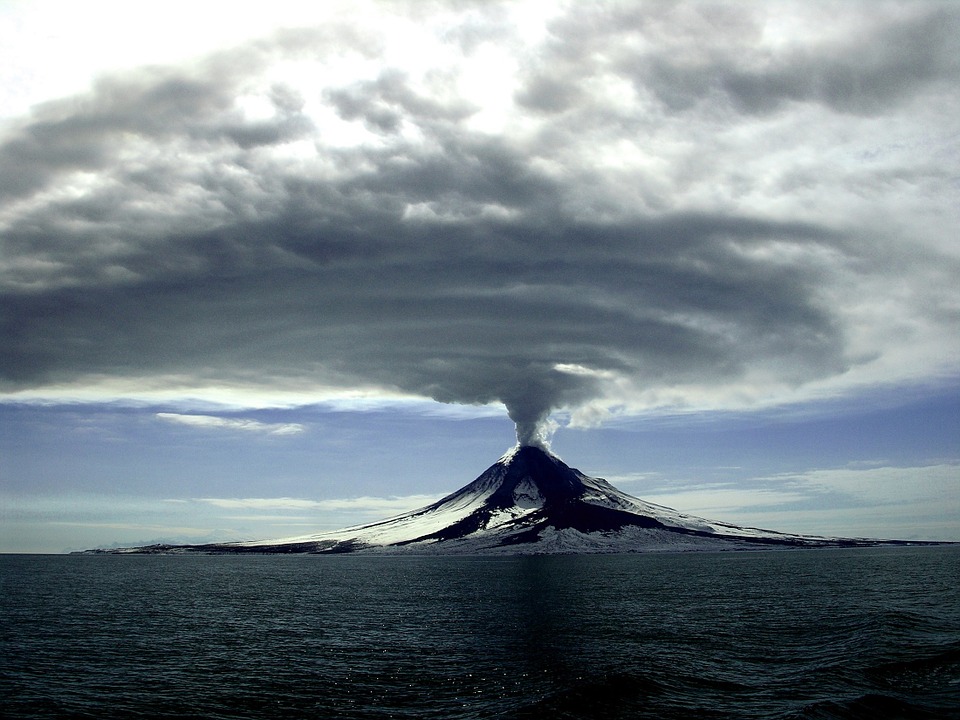
Massive eruptions of Hawaii’s Kilauea volcano and Guatemala’s Fuego volcano have captivated the entire world in recent days, and now it looks like even more volcanoes are starting to wake up.  In fact, yellow alerts were just issued for Mexico’s Mt. Popocatepetl and Alaska’s Great Sitkin volcano.  Mt. Popocatepetl and Great Sitkin both sit along the “Ring of Fire” that roughly encircles the perimeter of the Pacific Ocean, and many are becoming concerned that we may be witnessing some sort of “chain reaction” as volcanoes all over the globe begin to exhibit signs of increased activity.  This even includes some unusual happenings at Yellowstone, and we will cover that near the end of this article.  But to start with, let’s take a look at the yellow alert that was just issued for Mt. Popocatepetl.  The following comes from a government website in Mexico

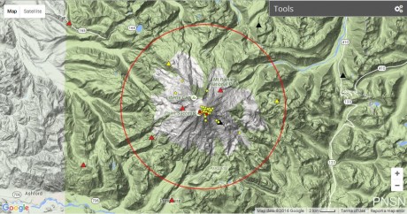
In the last 24 hours, through the monitoring systems at Popocatépetl volcano, were registered 30 exhalations with emissions of steam and gas (image 1). At night was possible to observed incandescence that increase with some exhalations (image 2).

At the time of this report the emission are dispersed to the south-southwest direction (image 3).

CENAPRED emphasizes that people SHOULD NOT go near the volcano, especially near the crater, due to the hazard caused by ballistic fragments (image 4) and in case of heavy rains leave the bottoms of ravines by the danger of landslides and debris flows.

The Volcanic Traffic Light Yellow Phase 2.

The scenarios foreseen for this phase are:

1. Explosive activity of low to intermediate level.

2. Ash fall in nearby towns.

3. Possibility of short range pyroclastic flows and mudflows.

Any signs of activity at Mt. Popocatepetl should always be taken very, very seriously.

It is known as the most dangerous volcano in North America for a reason.  Experts tell us that centuries ago this volcano actually “covered entire Aztec cities” with super-heated mud…

Historians tell us that Popocatepetl had a dramatic impact on the ancient Aztecs. Giant mud flows produced by massive eruptions covered entire Aztec cities. In fact, some of these mud flows were so large that they buried entire pyramids in super-heated mud.

But we haven’t witnessed anything like that in any of our lifetimes, so it is hard to even imagine devastation of that magnitude.

In addition to Mexico City’s mammoth population, there are millions of others that live in the surrounding region. Overall, there are about 25 million people that live in the immediate vicinity of Popocatepetl. Thankfully, we haven’t seen a major eruption of the volcano in modern times, but at some point that will change.

In a worst case scenario, Mt. Popocatepetl could absolutely devastate Mexico City, kill countless numbers of people and collapse the Mexican economy overnight.

So let us pray that we don’t see a major eruption there any time soon.

Meanwhile, a yellow alert has also been issued for Alaska’s Great Sitkin volcano.  The following comes from the Alaska Volcano Observatory

AVO/USGS Volcanic Activity Notice

Volcano: Great Sitkin (VNUM #311120)

Current Volcano Alert Level: ADVISORY
Previous Volcano Alert Level: NORMAL

Current Aviation Color Code: YELLOW
Previous Aviation Color Code: GREEN

Issued: Sunday, June 10, 2018, 1:26 PM AKDT
Source: Alaska Volcano Observatory
Notice Number:
Location: N 52 deg 4 min W 176 deg 6 min
Elevation: 5709 ft (1740 m)
Area: Aleutians

Volcanic Activity Summary: Earthquake activity at Great Sitkin Volcano has been elevated over the past five days, and earlier today at 11:39 AKDT (19:39 UTC), a signal that may represent a short-lived steam explosion was detected by seismic data. AVO is thus raising the Aviation Color Code and Alert Level to YELLOW/ADVISORY.

Great Sitkin Volcano is monitored by a five-station seismic network on Great Sitkin Island and with additional seismic stations on the nearby islands of Igitkin, Adak, Kagalaska, and Kanaga. A six-element infrasound array to detect explosions (atmospheric pressure waves) was installed on Adak Island in June, 2017, although it is currently (June 2018) only partly operational. AVO also uses satellite imagery to monitor Great Sitkin Volcano.

Recent Observations:
[Volcanic cloud height] not applicable
[Other volcanic cloud information] Unknown

Remarks: Great Sitkin Volcano is a basaltic andesite volcano that occupies most of the northern half of Great Sitkin Island, a member of the Andreanof Islands group in the central Aleutian Islands. It is located 43 km (26 miles) east of the community of Adak. Great Sitkin erupted at least three times in the 20th century, most recently in 1974. That eruption produced at least one ash cloud that likely exceeded an altitude of 25,000 ft above sea level. A poorly documented eruption occurred in 1945, also producing a lava dome that was partially destroyed in the 1974 eruption. A seismic swarm occurred from July 2016 through the end of 2017.

Unlike  Mt. Popocatepetl, Great Sitkin is located very far away from any large population centers, and so even a full-blown eruption of that volcano would not be that catastrophic.

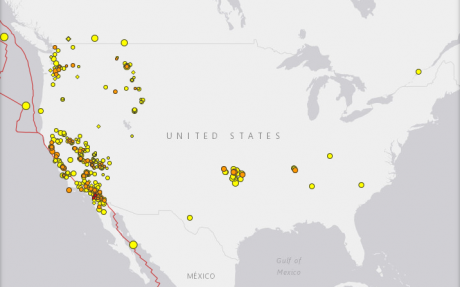
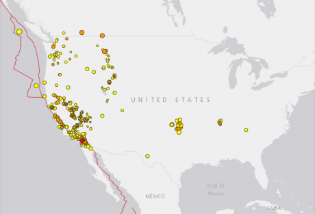
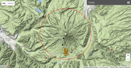
Of course the same cannot be said about Yellowstone.  As I have written about many times, a full-blown eruption at Yellowstone could potentially change all of our lives in a single moment.  That is why the unusual activity that is happening there right now is such a concern

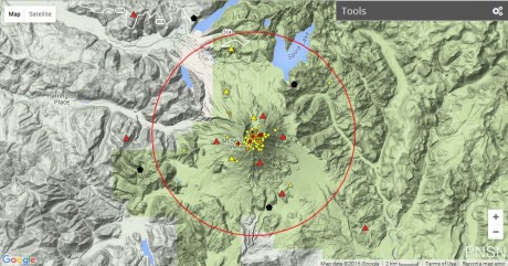
Yellowstone’s Steamboat Geyser, the largest in the world, has now erupted eight times in less than three months, in a geological puzzle that has fascinated scientists working at the site.

The most recent Steamboat eruption occurred Monday just after 9 a.m. “It was unbelievable,” Jamie Farrell, a geologist at the University of Utah who happened to be at the geyser during the eruption, told Newsweek. He’s seen plenty of other geysers go off—but not Steamboat, which is capable of the largest eruptions of all currently active geysers.

Eruptions of Steamboat do not happen that often.  As Mac Slavo has noted, the last one was in September 2014…

Until this recent series of eruptions, the last time Steamboat blew was in September 2014. Steamboat’s latest eruption was Monday morning when the geyser shot boiling hot water hundreds of feet into the air. Steam billowed from the geyser for hours longer. Steamboat is located in the Norris Geyser Basin, known to have the hottest and most changeable thermal area in nearly 3,500-square-mile wilderness park that sits on a volcanic hot spot called a caldera. That accounts for the geyser’s towering columns of steam (it’s very, very hot underground) but leaves a major fear-provoking question unanswered: Why now, and is it a sign the giant volcano is waking up?

We better hope that Yellowstone is not awakening.  In a previous article, I described what a full-blown eruption of Yellowstone might look like…

Hundreds of cubic miles of ash, rock and lava would be blasted into the atmosphere, and this would likely plunge much of the northern hemisphere into several days of complete darkness. Virtually everything within 100 miles of Yellowstone would be immediately killed, but a much more cruel fate would befall those that live in major cities outside of the immediate blast zone such as Salt Lake City and Denver.

Hot volcanic ash, rock and dust would rain down on those cities literally for weeks. In the end, it would be extremely difficult for anyone living in those communities to survive. In fact, it has been estimated that 90 percent of all people living within 600 miles of Yellowstone would be killed.

Experts project that such an eruption would dump a layer of volcanic ash that is at least 10 feet deep up to 1,000 miles away, and approximately two-thirds of the United States would suddenly become uninhabitable. The volcanic ash would severely contaminate most of our water supplies, and growing food in the middle of the country would become next to impossible.

In other words, it would be the end of our country as we know it today.

Throughout human history, great societies have been taken down by natural disasters, and despite all of our advanced technology we are extremely vulnerable as well.

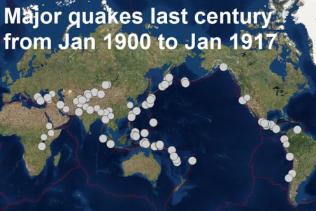
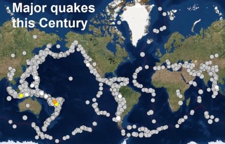
So the fact that our planet is becoming increasingly unstable is a major concern, and I believe that this is going to have major implications for our future.

Michael Snyder is a nationally syndicated writer, media personality and political activist. He is the author of four books including The Beginning Of The End and Living A Life That Really Matters.

Strong Earthquakes Hit San Francisco And Mount St. Helens And Experts Warn They May Be Foreshocks For ‘Something Larger’

Just when it seemed like things may be settling down, two very unusual earthquakes have hit the west coast within the past couple of days.  A 4.4 magnitude quake struck Berkeley, California just prior to 3 AM on Thursday morning, and a 3.9 magnitude earthquake hit Mount St. Helens in Washington state on Wednesday.  Overall, there have been 68 earthquakes in the vicinity of Mount St. Helens since New Year’s Day, and there have been a total of 629 earthquakes in the state of California within the last 30 days.  Could it be possible that all of this activity is leading up to a historic seismic disaster on the west coast?

The 4.4 magnitude earthquake along the Hayward fault very early on Thursday jolted people out of bed all over the San Francisco area

A strong 4.4 magnitude earthquake has rattled the Bay Area shortly before 3 a.m.

USGS is reporting the quake was centered in Berkeley. On KRON4’s real time earthquake map it shows the epicenter.

The quake struck at 2:39 a.m. and was centered near the Claremont hotel. The earthquake had a preliminary depth of 8 miles, according to USGS.

This wasn’t a soft and gentle earthquake that everyone kind of laughs about after it is over.

Rather, this was the kind of extremely intense earthquake that puts the fear of God into people.  In fact, one Bay area resident said that it “felt like a truck hit my house”

“I was actually awake putting my shoes on for work. It felt like a truck hit my house from the back which pushed my against the staircase railing, the walls were cracking and threw my cell phone and keys down the stairs. Pretty scary”

If this was the worst quake in this particular swarm, it won’t ultimately be that big of a deal.

However, USGS Geologist David Schwartz is warning that this 4.4 magnitude earthquake could potentially be “a foreshock of something larger”

“It is centered on about a five-mile-long section of the Hayward Fault that in the past 10 years has produced 30 earthquakes of magnitude between 3-4,” he told KPIX 5. “So it is a hot spot along the fault and this morning’s earthquake was the largest of that group.”

Schwartz said the real question in the hours after the quake was “is this a foreshock of something larger? That’s the concern.”

I have been writing about the shaking that has been happening on the west coast quite a bit lately, but I don’t think that people understand the seriousness of what we are facing.

Scientists assure us that the “Big One” is coming, and when it does arrive the devastation will be absolutely off the charts.  Just consider the words of seismologist Peggy Hellweg

Speaking to Daily Star Online, seismologist Peggy Hellweg, from the University of California, said the region is not prepared to deal with the fallout from such an earthquake.

She said that a magnitude 7 or greater earthquake could kill “tens of thousands of people”.

In financial terms, such a quake would likely cause “tens to hundreds of billions of dollars in damage”, she said.

And remember, she is talking about a magnitude 7 earthquake in her scenario.

A magnitude 9 earthquake would be many, many times more powerful, and it would easily be the worst natural disaster in the recorded history of the United States.

Meanwhile, Mount St. Helens was hit with a very unusual 3.9 magnitude earthquake on Thursday, and some believe that this could be a sign that the volcano is “recharging”

A series of 68 tremors, peaking with a magnitude 3.9 quake, have been detected in Washington state by scientists since New Years day.

The 3.9 quake is the second largest since 1981, the year after the natural disaster which killed 57 people and came minutes after a magnitude-5.1 earthquake.

Last month, seismologists at the University of Washington logged more than 80 quakes, four times as many as the average.

Earthquake swarms at Mount St. Helens are not unusual, but what we have seen over the first four days of 2018 has definitely gotten the attention of seismologists.

They are hoping that things will calm down at the volcano, but one seismologist did warn that “a larger quake could follow within 48 hours”.

We haven’t had a major volcanic eruption in the United States in a very long time, and so there is a lot of complacency out there right now.

But we should remember that the eruption of Mount St. Helens in 1980 was “the deadliest and most economically damaging volcanic event in the history of the United States.”  The following comes from Forbes

Mount St. Helens is most commonly known for its major eruption in 1980, the deadliest and most economically damaging volcanic event in the history of the United States. The stratovolcano is situated just 96 miles from Seattle and 50 miles from Portland, making an eruption especially dangerous.

And Mount St. Helens is certainly not the only threat.  Personally, I am so concerned about a potential eruption of Mount Rainier that I even included one in my novel.

With each passing year it appears that our planet is becoming increasingly unstable.  Many believe that we have entered a time when seismic activity will be much higher than it has been previously, and that is going to have dramatic implications for our society.

Our tech industry is very heavily concentrated along the west coast.  When the “Big One” does finally strike, it could literally crash our economy overnight.

What the day arrives, are you ready for what will happen next?

Michael Snyder is a pro-Trump candidate for Congress in Idaho’s First Congressional District, and you can learn how you can get involved in the campaign on his official website. His new book entitled “Living A Life That Really Matters” is available in paperback and for the Kindle on Amazon.com.

There Have Been 698 Earthquakes In California Within The Past 30 Days

Why is the west coast shaking so violently?  According to the latest data from Earthquake Track, there have been 698 earthquakes in California within the past 30 days.  By the time that you read this article, that number will undoubtedly have changed.  In recent days I have felt such an urgency to write about the seismic activity on the west coast, and I am quite concerned that so few people seem to be paying attention to what is happening.

As I have covered previously, scientists tell us that when seismic activity begins to escalate the probability of having a major earthquake jumps significantly.  Over the past month there have been more mainstream news articles about earthquake swarms in California than I have seen in years, and the magnitude 4.6 earthquake that rattled Monterey County earlier this month made headlines all over the world.

And it isn’t just the U.S. section of the “Ring of Fire” that seems to be awakening.  I have written about Mt. Popocatepetl down in Mexico several times recently, and on Friday it erupted three more times

Spectacular eruptions have been seen Southeast of Mexico City as Mexico’s Popocatepetl volcano spewed smoke and ash high into the air.

The volcano had three eruptions Friday, one of which reached two and a half miles into the sky.

The first explosion occurred at about 5:00 p.m. local time.

Two more explosions overnight spread ash over the villages and fields south of the volcano.

I cannot stress enough how potentially dangerous this situation could become.  In ancient times, Mt. Popocatepetl completely covered entire Aztec cities with massive amounts of super-heated mud.  Scientists assure us that someday Mt. Popocatepetl will once again erupt in a similar fashion, and the devastation that this will cause will be off the charts.

Meanwhile, an extremely dangerous volcano on the other side of the Ring of Fire is also rapidly coming to life.  When Mount Agung violently erupted in 1963, more than a thousand people were killed, and authorities are extremely concerned about the eruptions that are happening right now

Volcanic eruptions on the Indonesian resort island of Bali have prompted officials to cancel flights and move about 24,000 residents out of the way as a thick ash cloud from Mount Agung, thousands of meters high, drifts east and southeast along the archipelago.

Residents were evacuated from 224 points around the island while Lombok International Airport on Pulau Lombok, the island due east of Bali, has closed temporarily, said Ari Ahsan, spokesman for Ngurah Rai International Airport in Bali.

Over the weekend we witnessed eruption after eruption, and the column of ash coming from the volcano is now more than 4 miles high

The first eruption came around 5:30 p.m. local time (4:30 a.m. ET) Saturday, Bali’s Regional Disaster Management Agency said. More eruptions followed and continued into Sunday, with a “medium-pressure eruption” in the early evening that sent ash 2,000 meters into the air, the agency said.
By late Saturday, the volcanic ash plume had reached an altitude of 7,600 meters (4.7 miles), according to Australia’s Bureau of Meteorology.

But what is troubling authorities more than anything else is the fact that magma has been “detected close to the volcano’s surface”

It told people within a 7.5km exclusion zone to “immediately evacuate” in an “orderly and calm manner”

Magma – molten rock – has now been detected close to the volcano’s surface, said officials and volcanologists.

I know that the mainstream media is endlessly obsessed with covering the controversies surrounding President Trump, but to me all of this seismic activity that we are seeing along the Ring of Fire is the biggest news story in the entire world at the moment.

I am convinced that what we are witnessing is quite unusual.  All over the planet “dead volcanoes” are coming back to life, and major fault lines are being hit by a seemingly endless barrage of small to mid-size earthquakes.

Is it possible that all of this shaking is leading up to something?

Stay tuned, because I believe that what we have seen so far is only just the beginning…

Michael Snyder is a Republican candidate for Congress in Idaho’s First Congressional District, and you can learn how you can get involved in the campaign on his official website. His new book entitled “Living A Life That Really Matters” is available in paperback and for the Kindle on Amazon.com.

134 Earthquakes Strike The San Andreas Fault As The Shaking Of The Earth’s Crust Intensifies

Within the last 7 days, 134 earthquakes “have hammered a three-mile stretch around Monterey County on the San Andreas fault”.  17 of those earthquakes were of magnitude 2.5 or greater, and many believe that these quakes could be a warning sign that a much bigger quake is imminent.  Let’s hope not, because when the “Big One” finally strikes California we will witness devastation on a scale that is unlike anything that we have seen before in modern American history.  The Northridge earthquake of 1994 was crippling, but it was only a magnitude 6.7 quake.  Experts tell us that when the “Big One” finally hits, we could be looking at a quake of magnitude 9.0 or greater, and such a disaster would make the Northridge earthquake look like a Sunday picnic.

The San Andreas fault stretches for more than 700 miles along the California coast, and in a previous article I discussed how seismologists have warned that it could potentially “unzip all at once”.  There is a reason why it is one of the most famous earthquake faults in the entire world, and all of the shaking that we have seen over the past 7 days has many scientists deeply concerned

In the last week 134 earthquakes have hammered a three-mile stretch around Monterey County on the San Andreas fault.

Of those earthquakes, 17 were stronger than 2.5 magnitude and six of them were stronger than 3.0, with more tremors expected in the coming weeks, experts warn.

It follows fears raised last week that the ‘Big One’ is about to hit after a series of ten ‘mini quakes’ struck the same area.

Let us hope that forecast about “more tremors” is wrong, but those that study these things do acknowledge that the probability of a very large earthquake goes up once we start seeing a bunch of smaller quakes.  For example, in a previous article I included the following quote from the director of the Southern California Earthquake Center

‘Any time there is significant seismic activity in the vicinity of the San Andreas fault, we seismologists get nervous,’ Thomas Jordan, director of the Southern California Earthquake Center, told the LA Times last year.

‘Because we recognize that the probability of having a large earthquake goes up.’

And Mac Slavo recently pointed out that USGS seismologist Dr. Lucy Jones has warned that the “Big One” is way overdue…

Seismologist Dr. Lucy Jones, from the US Geological Survey, warned in a dramatic speech that people need to act to protect themselves rather than ignoring the threat. Jones said people’s decision not to accept it will only mean more suffer as scientists warn the ‘Big One’ is now overdue to hit California. In a keynote speech to a meeting of the Japan Geoscience Union and the American Geophysical Union, Dr. Jones warned that the public is yet to accept the randomness of future earthquakes.

People tend to focus on earthquakes happening in the next 30 years but they should be preparing now, she warned. Jones said there are three key reasons why the peril is so frightening – it cannot be seen, it is uncertain, and it seems unknowable. This means people bury their heads in the sand and pretend it won’t happen when they should be prepared and soon for the “big one.”

Of course the shaking that we are currently witnessing in California is far from isolated.

All over the planet we are seeing some very unusual things happen right now.  For example, an enormous volcano in Iceland that has not erupted in 290 years is starting to come to life

A massive ice cauldron measuring one km in diameter has formed at the epicentre of the Öræfajökull volcano.

Stunning satellite images taken during a flyover of the region show the new ice cauldron has developed within the volcano in the last week.

This suggests that activity at the volcano, located in Vatnajökull, Iceland’s largest glacier, is increasing, according to the Icelandic Met Office (IMO).

And officials in Indonesia are warning that Mt. Agung may be about to experience a major eruption for the first time since 1963.  The following comes from TruNews

Indonesia’s Mt. Agung volcano on the island of Bali has erupted, prompting officials to prepare for possible mass evacuations from the popular tourist destination.

Indonesia’s National Disaster Mitigation Agency was already warning residents and tourists to stay away from an exclusion zone of roughly five miles around the crater. Their warning states the eruption could result in ash clouds that “severely disrupt air travel,” or cause disastrous environmental hazards.

While a main blast has not yet occurred, officials believe it is likely to happen soon. The last such eruption occurred in 1963 and resulted in the deaths of more than 1,000 people.

As I have said so many times before, it appears that the crust of our planet is becoming increasing unstable.  This is especially true along “the Ring of Fire”, and the fact that the section of the Ring of Fire that runs along the west coast seems to be awakening should be a major red flag for all of us.

They don’t know exactly when it will happen, but scientists assure us that it is just a matter of time before an absolutely catastrophic earthquake strikes the California coast.

So do you believe that this is a major threat?  Please feel free to tell us what you think by posting a comment below…

Michael Snyder is a Republican candidate for Congress in Idaho’s First Congressional District, and you can learn how you can get involved in the campaign on his official website. His new book entitled “Living A Life That Really Matters” is available in paperback and for the Kindle on Amazon.com.

California Residents On Edge After A Swarm Of 10 Earthquakes Hits Near The San Andreas Fault

Is the San Andreas Fault starting to wake up?  On Monday, a “swarm” of 10 significant earthquakes struck Monterey County, California.  The largest was a magnitude 4.6 earthquake that could be felt all the way over in San Francisco.  Of course this comes at a time when other portions of “the Ring of Fire” are starting to awaken as well.  For example, just yesterday I wrote about the alarming eruption of Mt. Popocatepetl that just took place down in Mexico.  For decades the west coast of North America has been relatively stable compared to the rest of the Ring of Fire, but now that is changing.

So should those living along the west coast be on alert?  Without a doubt, the shaking that happened on Monday definitely got a lot of attention…

A 4.6-magnitude earthquake rattled Monterey County on Monday and was felt more than 90 miles away in San Francisco, officials said.

The quake hit at 11:31 a.m. about 13 miles northeast of Gonzales, near Salinas, and was followed by nine smaller aftershocks, with the largest measuring magnitude 2.8, said Annemarie Baltay, a seismologist with the U.S. Geological Survey in Menlo Park.

Some experts are trying to assure us that we have nothing to be concerned about, but others are claiming that an earthquake swarm such as this “dramatically increases the likelihood of a major quake in California”.  And not too long ago, the director of the Southern California Earthquake Center did admit the following

‘Any time there is significant seismic activity in the vicinity of the San Andreas fault, we seismologists get nervous,’ Thomas Jordan, director of the Southern California Earthquake Center, told the LA Times last year.

‘Because we recognize that the probability of having a large earthquake goes up.’

Hopefully the shaking on the west coast will settle down and this will turn out to be a false alarm.

However, seismologists have warned us that the 800-mile-long San Andreas fault “could unzip all at once” without warning someday.  The following comes from Fox News

For years, scientists believed the mighty San Andreas—the 800-mile-long fault running the length of California where the Pacific and North American plates meet—could only rupture in isolated sections.

But a recent study by federal, state and academic researchers showed that much of the fault could unzip all at once, unleashing a rare, singular catastrophe. Now, insurers have used that research to come up with a new analysis of the damage that could be caused by statewide break of the San Andreas.

And just like we witnessed in Japan, a massive earthquake offshore could produce an enormous tsunami which could potentially “wash away coastal towns”.  The following comes from the Los Angeles Times

If a 9.0 earthquake were to strike along California’s sparsely populated North Coast, it would have a catastrophic ripple effect.

A giant tsunami created by the quake would wash away coastal towns, destroy U.S. 101 and cause $70 billion in damage over a large swath of the Pacific coast. More than 100 bridges would be lost, power lines toppled and coastal towns isolated. Residents would have as few as 15 minutes notice to flee to higher ground, and as many as 10,000 would perish.

Scientists last year published this grim scenario for a massive rupture along the Cascadia fault system, which runs 700 miles off shore from Northern California to Vancouver Island.

Scientists don’t know exactly when it will happen, but they promise us that “the Big One” is coming someday.

And based on all of the shaking that has been taking place lately, we may be a lot closer to that day than many imagined.

Michael Snyder is a Republican candidate for Congress in Idaho’s First Congressional District, and you can learn how you can get involved in the campaign on his official website. His new book entitled “Living A Life That Really Matters” is available in paperback and for the Kindle on Amazon.com.

Is Something Strange Happening Inside The Earth?

Volcano Lava Landscape - Public DomainWhy are “giant fountains of lava” suddenly pouring out of some of the most dangerous volcanoes on the entire planet, and why are so many long dormant volcanoes suddenly roaring back to life?  The spectacular eruption of Mt. Etna in Italy is making headlines all over the world, but it is far from alone.  According to Volcano Discovery, 35 major volcanoes either are erupting right now or have just recently erupted, and dozens of others are stirring.  So what is causing this upsurge in volcanic activity?  Is something strange happening inside the Earth?

According to the USGS, magma is “molten rock underground”, and lava is molten rock “that breaks through the Earth’s surface”.  Right now, something is pushing magma up through the crust of the Earth at a number of key spots around the planet.  On the island of Sicily, the “giant fountains of lava” that are coming out of Mt. Etna can be seen 30 kilometers away

Giant fountains of lava could be seen sprouting from the volcano, located on the isle of Sicily, as far away as Catania, around 30 kilometres away, and the resort town of Taormina.

The Meteorological Observatory in Nunziata said: “You can clearly see the lava fountains, although currently modest, as it escapes from the crater in the southeast.”

An orange air alert has been issued, meaning that airspace will remain open but authorities will continue to monitor the situation.

On the other side of the world, a constant stream of molten rock has been springing out of Guatemala’s “Volcano of Fire” since February 25th

Guatemala’s Volcano of Fire erupted Saturday (Feb 25), spewing lava and sending up plumes of ash that rained down on nearby communities and could eventually reach the capital, civil protection authorities said.

The Volcan de Fuego, one of the country’s three active volcanoes, is located about 45km southwest of the capital Guatemala City. It was the volcano’s second eruption this year.

And in the middle of the Pacific Ocean, a “firehose of lava” has been pouring out of the Kilauea Volcano since December 31st.

Meanwhile, a number of large volcanoes that have been dormant for a very long time all over the world have started springing back to life.

For instance, the only active volcano in India has suddenly started “spewing lava and ash” after being silent for 150 years…

Barren Islands volcano, India’s only active volcano, is reportedly spewing lava and ash after a gap of 150 years. It erupted for about four hours in January, scientists from the National Institute of Oceanography (NIO) claimed.

The volcano is situated in Barren Islands in the Andaman & Nicobar archipelago. Some unsubstantiated reports even claim that it is South Asia’s only active volcano.

Its first recorded eruption dates back to 1787. Since then, the volcano has erupted more than ten times, including the one this year.

At one time scientists would speak of “dead volcanoes”, but now we learning that it really isn’t safe to speak of any volcano as being completely “dead”.  So many of these long dormant volcanoes are roaring back to life, and why this is suddenly happening now is puzzling many of the experts.

And as you have seen, this isn’t isolated to just one or two geographic regions.  It literally is happening all over the globe.

Last month, Indonesia’s Mount Sinabung in the southern hemisphere erupted seven times in the space of a single day, and meanwhile authorities in the northern hemisphere were warning us that four of Iceland’s biggest volcanoes are preparing to erupt.

Indonesia and Iceland are about as far apart as you can get, and yet they are both being affected by this worldwide phenomenon.

Without a doubt, something definitely appears to be causing a significant increase in worldwide seismic activity.

Let’s talk about earthquakes for a moment.  A website known as the Big Wobble recently published an article that included two extraordinary maps.  The first map showed the number of major earthquakes from January 1900 to January 1917, and the second map showed the number of major earthquakes from January 2000 to January 2017.  The difference between the two maps was startling to say the least.

Big Wobble 1

Big Wobble 2

It is becoming extremely difficult to deny that something is happening to the crust of our planet, and many are becoming concerned about what we could soon experience if the level of seismic activity continues to rise.

We already talked about Mt. Etna, but a much greater threat in Italy appears to be awakening under the city of Naples.  A massive supervolcano known as “Campi Flegrei” is close to a “critical state”, and if it erupts the consequences will be beyond catastrophic.  The following comes from National Geographic

A long-quiet yet huge supervolcano that lies under 500,000 people in Italy may be waking up and approaching a “critical state,” scientists report this week in the journal Nature Communications.

Based on physical measurements and computer modeling, “we propose that magma could be approaching the CDP [critical degassing pressure] at Campi Flegrei, a volcano in the metropolitan area of Naples, one of the most densely inhabited areas in the world, and where accelerating deformation and heating are currently being observed,” wrote the scientists—who are led by Giovanni Chiodini of the Italian National Institute of Geophysics in Rome.

If that supervolcano were to fully erupt, millions could die, the skies in the northern hemisphere would be darkened for months and the resulting “volcanic winter” would cause famines all around the globe.

And the same things could be said about the supervolcano that is awakening in North Korea too.

In the United States, we should be watching the volcanoes on the west coast for signs of trouble, and my regular readers know that I am particularly concerned about Mt. Rainier.  There is an eruption of Mt. Rainier in “The Beginning Of The End“, and it is in there for a reason.

Someday Mt. Rainier will erupt, and the horror that this will mean for the Northwest is beyond anything that I could put into words for you right now.

We live at a time when our planet is becoming increasingly unstable, and a major natural disaster could change all of our lives in a single moment.

Just because our lives have been somewhat “normal” for an extended period of time does not mean that they will always be this way, and those that are ignoring the rumblings of our planet do so at their own peril.

40 Volcanoes Are Erupting Right Now As The Crust Of The Earth Becomes Increasingly Unstable

Volcano Erupting 2 - Public DomainHave you noticed that our planet has begun to shake, rattle and roll?  Over the past few days we have seen major volcanic eruptions in Costa Rica and Indonesia, and according to Volcano Discovery 40 volcanoes around the planet are erupting right now as you read this article.  Meanwhile, earthquakes continue to shake the globe with alarming regularity.  Just last week, Ecuador was hit by a magnitude 6.7 earthquake and a magnitude 6.8 earthquake in rapid succession.  Overall, there have been more than 3,000 earthquakes of magnitude 1.5 or greater within the past month globally.  So yes, I write constantly about the rapidly accelerating deterioration of our financial system, but the coming “collapse” is not just about money.  I am convinced that we are entering a “perfect storm” in which a confluence of factors will absolutely cripple society and bring about changes that most of us would not even dare to imagine right now.

Let’s talk about the volcanic eruptions that we have seen in recent days.  The eruption down in Costa Rica took authorities completely by surprise, and a thick layer of dust and ash is coating vehicles and buildings 30 miles away in the capital city of San Jose

A volcano has erupted in central Costa Rica, belching smoke and ash up to 3,000m (9,840ft) into the air.

Hundreds of people have gone to hospital, complaining of breathing difficulties and skin problems.

Some schools were shut and some flights into the country cancelled or diverted.

People in the capital San Jose, about 45km (30 miles) west of the Turrialba volcano, said layers of ash had coated buildings and cars and there was a fierce smell of sulphur.

Leading up to this eruption, there were “swarms of small earthquakes” in the vicinity of the volcano, but scientists assured the public that these earthquake swarms were “not signs of an imminent eruption.”

Keep that in mind, because later in the article I am going to show you something.

But first let us talk about the other major eruption that is happening right now.  Down in Indonesia, Mount Sinabung has violently erupted, and this is causing all sorts of chaos

The death toll from a volcanic eruption in western Indonesia has climbed to six, an official said Sunday, with fears more could have been trapped by the hot ash.

Three people also remain in a critical condition after Mount Sinabung, a highly-active volcano on Sumatra island, unleashed a series of fresh eruptions on Saturday afternoon, disaster agency spokesman Sutopo Purwo Nugroho said.

“Nine people were struck by the hot clouds. Six died, and three others remain critical with burns,” he said, adding the injured had been taken to hospital.

According to one report, “torrents of lava” are pouring out of the volcano, and this is just one example of how volcanoes that were once considered to be “inactive” are coming to life all over the world.  In fact, prior to 2010 Mount Sinabung had been dormant for about 400 years.

Meanwhile, there is “unprecedented” activity at Iceland’s very dangerous Baroabunga volcano.  This one is not erupting quite yet, but we definitely want to keep an eye on it, because a major eruption there would have serious implications for Europe.

To finish this article, I would like to provide an update to a piece that I posted last week on End of the American Dream.  Just prior to the eruption of the Turrialba volcano in Costa Rica, there were significant earthquake swarms in the vicinity of the volcano.  Well, the exact same thing is happening at three major volcanoes in the United States right now.

I would like to share three images with you that come from Google Earth via the Pacific Northwest Seismic Network.  This first image shows the earthquake activity that has taken place in the area around Mt. St. Helens in recent days.  Over the past month there have been 95 earthquakes in the region, and most of them have been centered right along the core of the volcano…

Mt. St. Helens Today

This next image shows what has been happening at Mt. Rainier.  Those that follow my work closely already know that I consider it to be the most dangerous mountain in America and that I believe that a major eruption of the volcano is coming in the not too distant future.  There have been 36 earthquakes at Mt. Rainier over the past month, and once again most of them have occurred right along the core of the volcano…

Mt. Rainier Today

Mt. Hood is also a very dangerous volcano.  There have been 126 earthquakes in the vicinity of Mt. Hood in recent days, and in this image you can see that the earthquakes have been centered very tightly on a spot on the south face of the mountain.  This is alarming because it was also the south side of Mt. St. Helens that violently erupted back in 1980…

Mt. Hood Today

When there are major volcanic eruptions or major earthquakes in other parts of the globe, many Americans don’t seem to care too much because they don’t think that this rise in global seismic activity is any sort of a threat to them personally.

But the truth is that the entire west coast of the United States lies along the Ring of Fire, and virtually every other section of the Ring of Fire is roaring to life these days.

At some point, there will be historic earthquakes on the west coast.

At some point, there will be historic volcanic eruptions on the west coast.

Scientists assure us that these things are inevitable.

So let us certainly hope for the best, but putting our heads in the sand and pretending that these dangers do not exist is not going to help matters one bit.

Get prepared while you still can, because at some point time will run out.

*About the author: Michael Snyder is the founder and publisher of The Economic Collapse Blog. Michael’s controversial new book about Bible prophecy entitled “The Rapture Verdict” is available in paperback and for the Kindle on Amazon.com.*

Earth Changes In 2016? How To Get Prepared For The Coming Earthquakes And Volcanic Eruptions

Four Horsemen - Public DomainAll over the world seismic activity is increasing.  In recent weeks we have seen a dramatic earthquake in Ecuador, more than 600 earthquakes have experts extremely alarmed about what is happening to Japan’s southern Island, and 37 volcanoes around the planet are erupting right now.  Most of the large earthquakes and volcanic eruptions that we have witnessed lately have come along the Ring of Fire, which is an area of seismic instability which roughly encircles the Pacific Ocean.  Fortunately the west coast of the United States has been spared so far, but scientists tell us that tension has been building up along the San Andreas fault and the Cascadia Subduction Zone for decades, and they assure us that it is only a matter of time before we see a major event.  What that day arrives, will you be prepared?

There were a couple of notable seismic events which took place on Monday.  First of all, the largest volcano in Russia’s Far East known as Klyuchevskaya Sopka violently erupted.  Steaming hot ash was shot more than three miles up into the air, but fortunately it is not a heavily populated area.  This represents yet another major volcanic eruption along the Ring of Fire, and this has some scientists extremely concerned about what may be coming next.

Here in the United States, an unusual swarm of 21 earthquakes along the Arizona-Nevada border is also raising eyebrows

More small earthquakes shook northwest Arizona Sunday adding to the list of temblors that have struck the area since March 29.

The Arizona Geological Survey said two quakes occurred, including a magnitude 2.6 quake at 12:07 a.m.

There has been a swarm of 21 quakes in an area along the Arizona-Nevada line south-southwest of Littlefield, AZ, which is also close to southwestern Utah and the frequency and span puzzles geologists.

The good news is that we have not had a truly historic earthquake in the U.S. for decades, and there have been no major volcanic eruptions since Mount St. Helens exploded back in 1980.

But scientists assure us that we are living on borrowed time, and there are three extremely dangerous volcanoes in North America that I am keeping a close watch on right now…

#1 Mt. Popocatepetl

Popocatepetl is an Aztec word that can be translated as “smoking mountain”, and more than 25 million people live within range of this extraordinarily dangerous mountain.  Experts tell us that during the time of the Aztecs, entire cities were completely buried in super-heated mud from this volcano.  In fact, the super-heated mud was so deep that it buried entire pyramids.  In the event of a full-blown eruption, Mexico City’s 18 million residents probably wouldn’t be buried in super-heated mud, but it would still be absolutely devastating for Mexico’s largest city.

#2 Mt. Rainier

Mt. Rainier has been dubbed a “time bomb“, “the most dangerous mountain in the United States” and “one of the most dangerous volcanoes in the world” because it sits so close to Seattle, Tacoma and other major cities along the coast of Washington state.  In the event of a full-blown eruption, countless numbers of people would literally be buried alive in a tsunami of super-heated mud.  These tsunamis of super-heated mud are known as “lahars”, and scientists believe that Mt. Rainier is capable of producing lahars that could move at speeds of up to 50 miles per hour.  I am so convinced that an eruption of Mt. Rainier is in our future that I even put one in my novel.

#3 The Yellowstone Supervolcano

Many of us that are a bit older still remember the eruption of Mount St. Helens back in 1980.  Well, scientists tell us that a full-blown eruption of the Yellowstone supervolcano would have up to 2,000 times the power of that eruption.  Salt Lake City would be toast, anything caught outside in Denver would probably be dead in pretty short order, and a layer of volcanic ash at least 10 feet deep would be dumped on everything even up to 1,000 miles away.  Food production in America would be virtually wiped out, and a “volcanic winter” would cool global temperatures by up to 20 degrees for an extended period of time.

In other words, life as we know it would come to an end.

That is why the extremely unusual activity going on at Yellowstone right now is such a concern.  If it decides to blow, world history will make a dramatic turn in a single moment.

So what should we do?

As always, we should never give in to fear.  There are definitely going to be major earthquakes and historic volcanic eruptions in North America, and we are going to have to deal with them.  Doing some common sense things in advance will give you and your family the best chance of calmly and smoothly making it through such a crisis.

Below, I have shared some tips that come directly from the CDC.  This first set of tips suggests things that you and your family can do to get prepared for a major earthquake…

—–

Gather Emergency Supplies

Stock up now on emergency supplies that can be used after an earthquake. These supplies should include a first aid kit, survival kits for the home, automobile, and workplace, and emergency water and food. Store enough supplies to last at least 3 days.

Evacuation Plans

If an earthquake occurs, you may need to evacuate a damaged area afterward. By planning and practicing for evacuation, you will be better prepared to respond appropriately and efficiently to signs of danger or to directions by civil authorities.

  • Take a few minutes with your family to discuss a home evacuation plan. Sketch a floor plan of your home; walk through each room and discuss evacuation details.
  • Plan a second way to exit from each room or area, if possible. If you need special equipment, such as a rope ladder, mark where it is located.
  • Mark where your emergency food, water, first aid kits, and fire extinguishers are located.
  • Mark where the utility switches or valves are located so that they can be turned off, if possible.
  • Indicate the location of your family’s emergency outdoor meeting place.

Establish Priorities

Take time before an earthquake strikes to write an emergency priority list, including:

  • important items to be hand-carried by you
  • other items, in order of importance to you and your family
  • items to be removed by car or truck if one is available
  • things to do if time permits, such as locking doors and windows, turning off the utilities, etc.

Write Down Important Information

Make a list of important information and put it in a secure location. Include on your list:

  • important telephone numbers, such as police, fire, paramedics, and medical centers
  • the names, addresses, and telephone numbers of your insurance agents, including policy types and numbers
  • the telephone numbers of the electric, gas, and water companies
  • the names and telephone numbers of neighbors
  • the name and telephone number of your landlord or property manager
  • important medical information, such as allergies, regular medications, etc.
  • the vehicle identification number, year, model, and license number of your automobile, boat, RV, etc.
  • your bank’s or credit union’s telephone number, account types, and numbers
  • radio and television broadcast stations to tune to for emergency broadcast information

Gather and Store Important Documents in a Fire-Proof Safe

  • Birth certificates
  • Ownership certificates (automobiles, boats, etc.)
  • Social Security cards
  • Insurance policies
  • Wills
  • Household inventory, including:
    • list of contents
    • photographs of contents of every room
    • photographs of items of high value, such as jewelry, paintings, collectors’ item

—–

Preparing for a volcanic eruption requires a strategy that is a little bit different.  Here are more tips from the CDC

—–

If you are told to evacuate

Follow authorities’ instructions if they tell you to leave the area. Though it may seem safe to stay at home and wait out an eruption, doing so could be very dangerous. Volcanoes spew hot, dangerous gases, ash, lava, and rock that are powerfully destructive.

Preparing to evacuate

  • Tune in the radio or television for volcano updates.
  • Listen for disaster sirens and warning signals.
  • Review your emergency plan and gather your emergency supplies. Be sure to pack at least a 1-week supply of prescription medications.
  • Prepare an emergency kit for your vehicle with food, flares, booster cables, maps, tools, a first aid kit, a fire extinguisher, sleeping bags, a flashlight, batteries, etc.
  • Fill your vehicle’s gas tank.
  • If no vehicle is available, make arrangements with friends or family for transportation, or follow authorities’ instructions on where to obtain transportation.
  • Place vehicles under cover, if at all possible.
  • Put livestock in an enclosed area. Plan ahead to take pets with you, but be aware that many emergency shelters cannot accept animals.
  • Fill your clean water containers.
  • Fill sinks and bathtubs with water as an extra supply for washing.
  • Adjust the thermostat on refrigerators and freezers to the coolest possible temperature. If the power goes out, food will stay cooler longer.

As you evacuate

  • Take only essential items with you, including at least a 1-week supply of prescription medications.
  • If you have time, turn off the gas, electricity, and water.
  • Disconnect appliances to reduce the likelihood of electrical shock when power is restored.
  • Make sure your automobile’s emergency kit is ready.
  • Follow designated evacuation routes—others may be blocked—and expect heavy traffic and delays.

If you are told to take shelter where you are

  • Keep listening to your radio or television until you are told all is safe or you are told to evacuate. Local authorities may evacuate specific areas at greatest risk in your community.
  • Close and lock all windows and outside doors.
  • Turn off all heating and air conditioning systems and fans.
  • Close the fireplace damper.
  • Organize your emergency supplies and make sure household members know where the supplies are.
  • Make sure the radio is working.
  • Go to an interior room without windows that is above ground level.
  • Bring your pets with you, and be sure to bring additional food and water supplies for them.
  • It is ideal to have a hard-wired (non-portable) telephone in the room you select. Call your emergency contact—a friend or family member who does not live near the volcano—and have the phone available if you need to report a life-threatening condition. Remember that telephone equipment may be overwhelmed or damaged during an emergency.

—–

In the end, you have got to do what you feel is best for you and your family.

Personally, I would be extremely hesitant to live in very high risk areas along the west coast or near the Yellowstone supervolcano.  This is especially true considering how dramatically global seismic activity is increasing.

But others point to the fact that these “danger areas” have not seen any major events in decades, so they wonder what all of the fuss is about.

So what do you think?  Please feel free to join the discussion by posting a comment below…

*About the author: Michael Snyder is the founder and publisher of The Economic Collapse Blog. Michael’s controversial new book about Bible prophecy entitled “The Rapture Verdict” is available in paperback and for the Kindle on Amazon.com.*